
|
||||||||||||||||

|
All day, every day, digital networks around the world watch the earth's slightest movements and report them to Web servers. Want to see where the biggest quakes have been this week? Follow a few of the links below to see what's shaking in your neighborhood and around the world. While you're at it, stop a moment and think about how important these sites are for seismologists. These Internet pages and the data associated with them allow scientists all over the globe to share information immediately and accurately. The advent of the Web has dramatically improved seismology. |
|
Here are a few choice sites featuring live earthquake data:
|
||
|
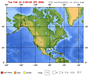
Quakes in the last 7 days: USGS Earthquake Hazards Program
The USGS has many maps of live earthquake data. This section lets visitors see quakes that have occurred anywhere in the world in the last week. You can also focus on geographic regions. Zooming in to a specific quake, you reach a page with specific data and links to the area's seimic and quake damage history. |
|
|
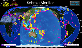
IRIS Seismic Monitor
|
|
|
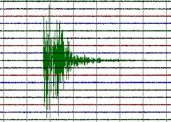
Real-time seismograms
Recorded by stations in the Northern California Seismic Network, these seismograms update every 5 minutes. The site also includes information on interpreting seismograms and examples of different magnitudes. |
|
|
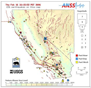
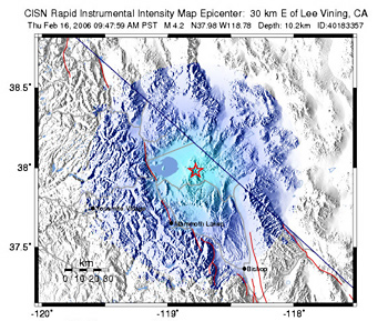
Shake map of California and Nevada showing fault lines
These maps are nice illustrations of the fact that earthquakes occur along faults. You can click the small boxes to zoom in and get more details on specific quakes. |
|
|
Did you feel it?
|
|
|
|
|
Live Eye • Great Shakes • Quake Basics • Damage Control • Active Zone