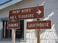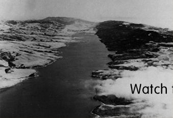

Besides the Carrizo Plain , Tomales Bay at Point Reyes has to be one of the most visually spectacular manifestations of the San Andreas fault. Tomales Bay is essentially a long sag pond - a place where the fault spreads and a depression is formed in the landscape. Often times a sag pond becomes a little lake or a marsh or sometimes is improved into serving as a water resevoir. This time, however, one end of the sag opens up into the Pacific Ocean.
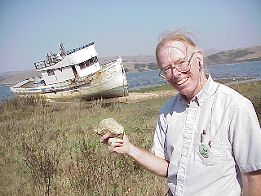
What is interesting about Tomales Bay and this part of the faultline is that there is a clear distiniction between the kind of rock on western shores of Tomales Bay (Point Reyes National Seashore) and the kind of rock found on the east shore. In the picture on the right, Paul is holding a piece of granite that can only be found on the Point Reyes side (the Pacific plate side) of the fault. This is because the land on the Pacific plate has been moving north steadily for millions of years, and the granite Paul is holding most likely originates 300 miles south in the southern Sierra Nevadas. This rock is stunning evidence of plate tectonics !
From this last Faultline Project location on the waters of Tomales Bay, the crew packed up and trucked south to our respective homes in San Francisco, Menlo Park and Los Angeles. Back to our lives on the faultlines-but not without a new appreciation for the geologic forces that are responsible for the ever-changing and volatile topography of the land we call home, California.