|
The
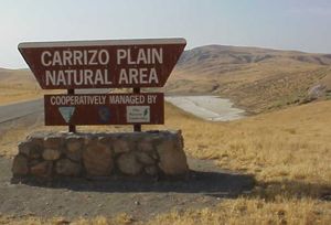
Carrizo Plain
Natural Area is one of the most desolate and stark landscapes in California.
It is located in a valley west of Bakersfield and east of San Luis Obispo,
out of the way of most traffic patterns and with nearly zero population.
Devoid of much vegetation except grass, the golden hills of the Carrizo
Plain feature the most clearly visible evidence of the San Andreas fault
anywhere in California.
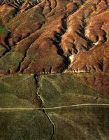
From
the air
, the fault looks like a gash cut across the surface of the earth.
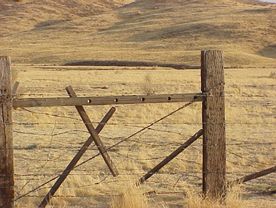
From the ground, offset creeks and sag ponds offer tangible evidence that
you are no doubt located in the "belly of the beast". At Wallace Creek,
geologist
Charles
Rubin
from Central Washington University is planning a new trench where
he'll be able to interpret the language of the earth's layers to determine
a pre-written human history of earthquakes in this area. This type of research
is called
paleoseismology
.
Often, the goal of paleoseismology is to be able to predict a seismically-active
region's recurrence interval; that is, about how much time passes between
major earthquakes in that area. The most common and successful technique
used by modern paleoseismologists is trenchingÑthe digging of trenches in
strategic locations of earthquake-prone areas. The soil and rock revealed
can show evidence of prior earthquakes, such as rock layers that are shifted
or displaced. By carefully measuring and dating such features, scientists
can learn when and where earthquakes have occurred, how big they were, and
with what frequency they strike. More than just a matter of academic interest,
this information can be crucial in deciding whether an area is safe to build
on.
|
|
|